
價格:免費
更新日期:2017-04-04
檔案大小:1.5 MB
目前版本:1.2
版本需求:需要 iOS 8.0 或以上版本。與 iPhone、iPad 及 iPod touch 相容。
支援語言:英語
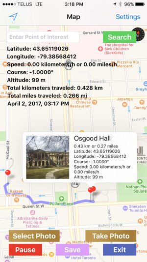
-This app marks your path on a map from where you started to walk or drive to where your current location is. The app works even when put in the background (i.e. when the home button was pressed).
-Latitude, longitude, speed, course (heading), altitude, total distance traveled in kilometres and miles and a date and time stamp are shown on a map overlay in real time.
-Waypoint pins are dropped on the map by a long touch and callouts are displayed by a regular touch on the pins. This latter action displays the point of interest entered previously in a text field, a thumbnail of a photo that was taken with the device's camera or selected from the "Photos" app and the distance traveled at the time the pin was dropped.

-An unlimited number of waypoints can be dropped, but the number of waypoints that include a photo is limited to 12.
-The text field together with a "Search" button can also be used as input for searching locations.
-The "Save" button takes a screenshot and saves it to the "Photos"app.
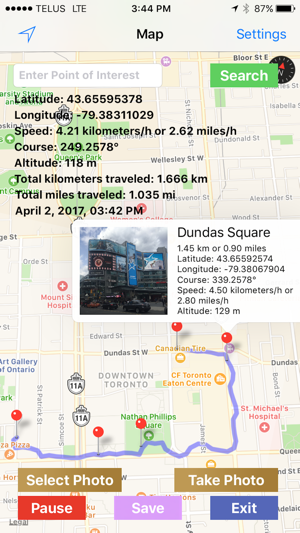
-A pair of "Pause" and "Resume" buttons stops tracking and starts tracking again. This function is useful when the device is stationary for longer periods of time.
-Screenshots could be made at any time to record the progression of map tracking with a tap on a "Save" button.
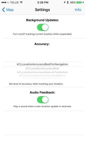
-On the "Settings" view there are 6 accuracy modes.
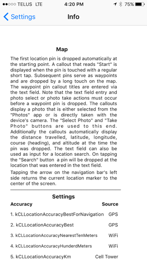
-Detailed instructions are provided on a separate "Info" view.
-No account sign-up, log-in, or in-app purchases are necessary. Just install and run.
-This app may use your location even when it isn't open, which can decrease device battery life.
支援平台:iPhone